Example Seaward Brief
Trip Brief
A sample output for a safety-first family day trip along the Massachusetts coast. The layout now leads with the departure checklist before the evidence.
Departure summary
Date
Feb 1, 2026
Window
9-11am to 4pm
Vessel
22 ft · Power (planing) · 3 draft · 9 ft air draft
Area
Charlestown, MA
Go/no-go checklist
Use this departure checklist just before leaving. Seaward highlights route-specific weather, notice, and timing checks, but the final departure decision is yours.
Do you have a current, reliable forecast for the full trip window?
Latest marine forecast is current for your trip date and supports a cautious day-trip plan.
Check before departure: Confirm the latest marine forecast is still current at departure time.
Are wind, waves, visibility, and weather still inside your comfort margin?
Wind: Light NE breeze 10-15 kt - comfortable for a family day sail. Waves: 1-2 ft chop - manageable motion in open stretches. Visibility: Generally good, but monitor for brief haze near showers. Weather: Gray with scattered showers rather than convective weather.
Check before departure: Compare the latest forecast details to your comfort margin before leaving the dock.
Are there any active advisories or warnings that change the risk picture?
No weather advisories were surfaced in this brief, but you should still verify the latest forecast products before departure.
Check before departure: Check for newly issued advisories or warnings before casting off.
Have you confirmed that active LNMs do not block or materially change your plan?
Temporary channel closure - Inner Harbor: Close to your planned departure and active during your trip window.
Check before departure: Keep clear of the closure and verify latest notice status.
Do tide/current timing and return timing still work for this trip?
Strong ebb current is expected near Boston Harbor around Feb 1, 2:30 PM.
Check before departure: Confirm departure, the most exposed leg, and the return window against current timing before you go.
Does the harbor departure still fit the simpler, family-style trip you intended?
The inner harbor departure is workable, but traffic and work-zone compression make the first leg busier than the rest of the route.
Check before departure: If the harbor exit looks more complex than briefed, shorten the plan to the most sheltered leg.
Does this still fit the crew you have aboard today?
With kids aboard and an intermediate crew, this outing should stay inside an easy workload envelope from the start.
Check before departure: Brief roles and turn-back thresholds before leaving the dock.
Does the boat still fit the shoaling-sensitive parts of this plan?
This boat's draft matters near the shoaling approach, especially if the tide is still low on arrival.
Check before departure: Verify approach depth before committing to the destination stop.
If conditions worsen, do you still have obvious shelter and bailout options along this route?
Short transitions between sheltered coves and busier fairways create natural reassessment points on this day trip.
Check before departure: Review the easiest turn-back and shelter options before departure.
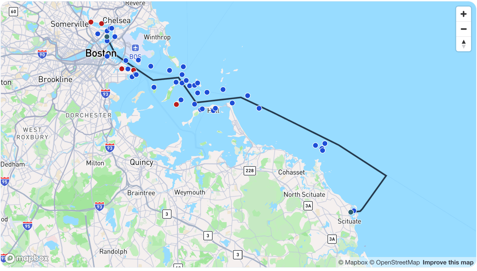
Route Map & Notice Overlays
Static preview of the route footprint and the notices referenced above.
Local Knowledge & Route Notes
From the inner harbor departure, expect dense crossing traffic and constrained maneuver room near channel entries, so plan a cautious pace until clear of the busiest approaches.
For your anchorage intent, treat short transitions between sheltered coves and busier fairways as verification points for tide/current timing rather than fixed assumptions.
Near the destination pier, maintain low speed and be prepared for ferry wakes; brief crew roles early so docking and line handling stay controlled.
How this was tailored to your plan
Used: tripDate, departureWindow, experienceLevel, crewCount, kidsAboard, constraints, tripContext, localFamiliarity
Missing/Not applicable: plannedEndTime, comfortPreset
Notices That Affect This Trip
Temporary channel closure - Inner Harbor
Close to your planned departure and active during your trip window.
Action: Keep clear of the closure and verify latest notice status.
Shoaling reported near approach
Soundings near the approach are below your draft at low tide.
Action: Plan arrival on a rising tide and verify depths with local notices.
Conditions & Timing
Latest marine forecast is current for your trip date and supports a cautious day-trip plan.
Tide/current interpretation covers your likely outing window from Feb 1, 9:00 AM to Feb 1, 4:00 PM using nearby tide and current stations.
Expected Conditions
- Wind
- Light NE breeze 10-15 kt - comfortable for a family day sail.
- Waves
- 1-2 ft chop - manageable motion in open stretches.
- Visibility
- Generally good, but monitor for brief haze near showers.
- Weather
- Gray with scattered showers rather than convective weather.
- Trend
- Steady through the day with no major deterioration expected.
What It Means for This Trip
- Comfortable boating weather for a safety-first day sail.
- Expect light chop and a damp, gray feel rather than rough conditions.
Timing Risks
- Strong ebb current is expected near Boston Harbor around Feb 1, 2:30 PM. If you are transiting a constricted or exposed passage then, expect more adverse current and steeper chop if wind opposes the ebb.
- High tide near Boston is expected around Feb 1, 12:48 PM; water will begin falling after that.
Seasonal & Local Patterns
For an early-February harbor trip, expect the strongest gales to favor easterly or northeasterly setups, with open-water conditions turning rougher faster than the inner harbor suggests.
Fog is a year-round possibility here and is more common toward the outer harbor and open water; easterly through southwesterly flow tends to bring it in, while westerly or northerly flow is more likely to clear it out.
Weather source zones
Supporting tide/current station data
Data Used
Boston (tide)
Confidence: high · Selected from route · Route distance 1.0 nm
Boston Harbor Entrance (current)
Confidence: medium · Selected from route · Route distance 1.8 nm
Nearest available station may not fully represent localized conditions on your route.
Station Events
| Station | Event | Time | Value | Fit |
|---|---|---|---|---|
| Boston | High Tide | Feb 1, 12:48 PM | 10.4 ft | high |
| Boston Harbor Entrance | Max Ebb | Feb 1, 2:30 PM | 2.4 kt | medium |
Captain's Notes
- Day trip with family crew; a cautious pace fits your experience profile.
- Latest marine forecast is current for the planned trip date, but still verify the newest update before departure.
- Primary goal is a sheltered, low-stress outing with simple decision points.
- Verify weather, notices, and tides/currents before departure.