Plan your boating day with one clear brief and a shareable float plan.
Seaward turns your route sketch into a safety-first summary with hazard highlights, local context, and a shore-contact float plan you can share before leaving.
3 min
Average brief build
NOAA + USCG
Primary sources
Map-first
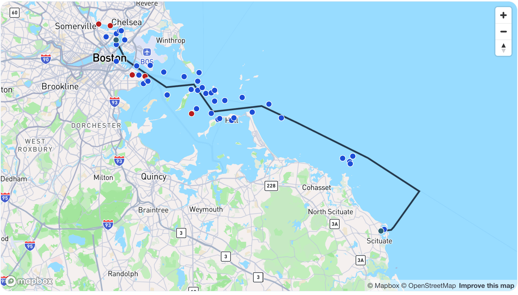
Sketch your route once
Shareable
Float plan link + PDF

Trip map with local notice overlays so hazards are easy to spot.
Plain-language route notes based on official local guidance.
Safety-first assumptions with confidence notes and source links.
What you get
A simple planning brief and a shareable safety record.
The Seaward Brief combines Coast Pilot notes, U.S. Coast Guard local notices, weather, and tide/current context into one place so you can scan the map, review key points, and make your own departure call. From the same saved trip, you can prepare a float plan for the trusted people ashore who should know where you are going and when to expect you back.
- Trip map and high-priority notice alerts
- Route notes in short, plain-language paragraphs
- Trip digest with safety-first defaults
- Assumptions, confidence levels, and source links
- Shareable float plan link and printable PDF
- Float plan details for trusted contacts
Float plans
Share the plan someone ashore needs.
Build a float plan from your saved trip, add vessel, crew, contact, safety, and itinerary details, then publish a private share link or printable PDF for trusted shore contacts.
Brief vs float plan
Two planning tools, one saved trip.
Seaward Brief
Route-aware planning context for hazards, weather, tides, currents, local notices, and conservative pre-departure checks. Generating a brief uses credits.
Float Plan
A shore-contact safety record with vessel, crew, contact, itinerary, communications, and safety details. Sharing links and PDFs do not use credits.
Why generate a brief?
Fewer missed details before you leave the dock.
A Seaward Brief connects your route sketch, timing, boat, and crew to official-source planning context so you can review hazards, notices, weather, tides, currents, assumptions, and source links in one place.
How it works
Step 1
Save your trip details, route sketch, vessel, crew, and timing.
Step 2
Generate your Seaward Brief when the plan is ready.
Step 3
Prepare a float plan with contact, safety, and itinerary details.
Step 4
Share the link or PDF with trusted people ashore.
Built for planning, not autopilot.
Always verify weather, tides/currents, notices, and charts before you depart.
What's inside a Seaward Brief
- Trip map and local notice summary
- High-priority local notice callouts
- Coast Pilot Digest
- Trip Digest
- Assumptions & Confidence
- Sources Consulted
FAQ
Common questions
Is Seaward a replacement for charts or navigation apps?
No. Seaward is a planning aid; always navigate with current charts, onboard instruments, and proper seamanship.
How current is the information in my brief?
Seaward uses official sources and recent notice data, but conditions can change quickly, so always verify before departure.
Does a float plan cost extra?
No. Saving, editing, publishing, revoking, and regenerating a float plan link are included.
Who should receive my float plan?
Share it with trusted people ashore, such as a friend, relative, marina, or yacht club contact. Emergency services such as the USCG do not accept float plans directly; the person holding your plan should contact rescue authorities if you are overdue.